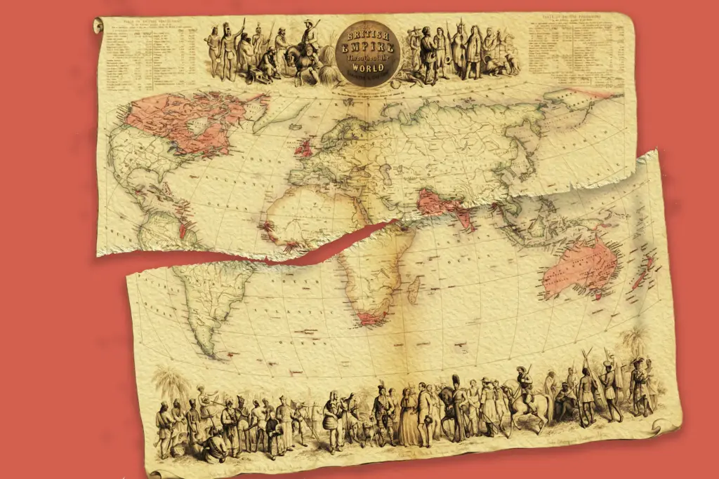
A photo montage of a 19th-century propaganda map—torn in half—titled "British Empire throughout the World Exhibited in One View," created by John Bartholomew Jr.. The map illustrates the global extent of British-occupied territories (shaded in red) during the mid-Victorian era. Photo: Chiqui Esteban/The Washington Post.
By Wayne Kublalsingh – Apr 22, 2026
The United States and Western Europe, nations like Germany, France, Britain, have always hatched up some fancy doctrines to hide and disguise their inherent fascism—a doctrine characterised by military and ideological repression and mass murder.
Consider the following doctrines: Democracy, Liberalism, Liberal Democracy, Christian Democracy, Democratic Socialism, Nationalism, Humanism, Conservatism, Republicanism. None of these doctrines has stopped the ruling elites of these nations from practising fascism, particularly against non-White peoples.
Ideological repression refers to the practice of mental violence. It promulgates the idea—through narratives on televisions, newspapers, books, social media, official releases and edicts—that non-White peoples are to blame for the wars committed against them. In other words, we will make every manner of war and mischief against you, and if you resist, we shall double-down, decimate you. Because it is your fault.
Fascism controls the global mainstream media. It, as they say, “manufactures consent”. It gets the historical victims and descendants of genocide, colonization and subjugation to agree that it is right to punish those who resist fascism. Resistance is terrorism. Deserving of sanction, subjugation, death, military bombardment. Fascism is naturalized, normalized, made to seem just, right, fit and proper.
Fascism is also racist. It does not see non-Whites on equal terms. White senators, presidents, experts, think-tank leaders, media and military personnel gospel racist attacks against non-White peoples, witless to their own scandalous and demonic depravity. The Guyanese/Barbadian historian Professor Richard Drayton, of Caucasian heritage, writes: “The US today is constitutionally incapable of negotiating with Iran, because it begins from a position of racialised contempt, thinks of Iran and Iranians as lesser than them.” (Facebook post, April 21, 2026).
Donald Trump is not alone in his fascism. Nor was Adolph Hitler. Think of the Spanish Inquisition, El Requerimiento, the genocidal conquistadors of the early 1500s, the Pilgrim Fathers, Puritan elders, colonists, who arrived in the Americas in the early 1600s, the Founding Fathers, Washington, Jefferson, who persisted with African slavery, Native Indian genocide under their democratic rule at the end of the 1700s, and the myriad 19th, 20th and 21st century wars, decapitations, conquests against the peoples of Australia, New Zealand, the Pacific (Hawaii and the Philippines), China, South East Asia, Africa, West Asia (the Middle East), Central and Latin America and the Caribbean.
White elite fascist rule has railroaded its own White and Non-White populations, their placards, sit-ins, public outcries, marches, demonstrations, to get what it wants: imperialism, colonialism and fascism. There have been no greater uprisings against the current Gaza genocide, the decapitation of Venezuela, the attempt to force-starve Cuba, the decapitation and criminal attacks on Iran, than those of White protesters in the US and Western Europe. But these too have been railroaded.
Fascism knows only one language. War. And it shall be defeated by only one language—war.
The current US/Israel war against Iran is far from over. Because fascism has not yet gotten what it wants. No regime change in Iran. No control of Iran’s oil production, price and trade. No destruction of Iran’s partners, Hamas, Hezbollah, the Houthis. No destruction of the Islamic Republic to facilitate Israel’s sworn Greater Israel project (like Hitler’s greater Germania project). And no effective control of the Straits of Hormuz.
In fact, Iran had wrested strategic advantage from Netanyahu and Trump. Despite suffering severely from high-altitude and sea-based Tomahawk platforms, Iran, with its drones and ballistic missiles has kept the enemy at bay. It has turned Israel’s famed Iron Dome into a brown paper bag. It has resisted a US/Israel ground attack 450 kms within Iran at Isfahan, (which houses the Isfahan Nuclear Technology Centre and the Pickaxe Mountain tunnel complex, which is believed to store enriched uranium). And it is profiting from its toll on tankers at Hormuz. And fascism is on the back foot!
At the centre of global media, Trump is up to his New York real-estate shyster’s tricks. “A shyster is a dishonest, unethical person, most commonly a lawyer or politician, who uses unscrupulous, tricky methods to get their way.” A thousand simultaneous contradictions. Glaring lies. Reversals. Madcap threats. Bi-polarising peace and war. All this is cover for more war, a “surprise” attack on Iran. He is planning a massive attack, using negotiation and peace as his ruse.
The world is waiting on Iran. All those historical victims of fascism in Asia, Australasia, Africa, Central and West Asia, Latin America and the Caribbean. And the non-White masses of the world. All the White and Non-White populations on the planet, with their placards, sit-ins, public outcries, marches, demonstrations, who have been advocating against imperialism, fascism, and their pet-child, genocide.
Waiting on Iran to win. To not take the bait of peace and negotiation. To not give up its nuclear enrichment program. To keep on standing with Palestine. To contain the deluded megalomania of Zionism. To drive out the US bases from the US Gulf fiefdoms. To defend and support resistance against terrorism, imperialism, fascism in the region. To fight for the sovereignty of its revolutionary Islamic Republic, its land and maritime borders. To decapitate the hegemonic US global financial architecture and petrodollar, which the US established after World War II.
Fascism is accustomed to getting what it wants. But not this time. Captain Fantastic has started a fight he cannot finish. US fascism has bounced its head in Iran. And it will not recover.